
March 2 2010
Hike at Casa Grande Mountain
It was a fasting day (every 3rd day of our dietary regimen), very pleasant temperatures, slightly overcast (thereby a reduction of glare) and it was a Tuesday - there would be few if any of the off-road vehicles present that make for a less than enjoyable hike in the desert. So we took a relatively short but somewhat circuitous drive of about 20 minutes to reach Casa Grande Mountain that is about 15 miles directly due south of our house.
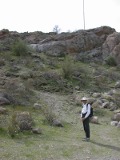
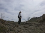 Paul patiently waited for Kitty to snap a photo as we started up the first of the rocky areas - away from the heavily off-road vehicle trails. For some unknown reason there is a flagpole on this small rise... apparently errected some long time past. And he waited for her at the saddlepoint before proceeding on.
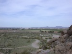
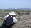 We stopped at this point to study what could be identified from this height - only to the north. Beyond the worn trails from various vehicles is Interstate 8 (school bus traveling to the east/right, in the first photo) and further out the (still) agricultural area of south Casa Grande. Paul makes use of the binoculars we brought along to see if he can pick out the area of our house at the foothills of the mountains in the far distance.
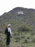 Over the previous rise is a valley fairly undisturbed by ATV/mountain bikers. The main peak visible from the north has a painted "CG" on its face - the paint frequently (?still yearly?) renewed by high school students as part of the football season. There are similarly painted initials of towns on closeby mountains in, at least this part of, Arizona - "C" for Coolidge, "F" for Florence, and 2 "A" mountains, Sentinel Peak for University of Arizona in Tucson and Tempe Butte for Arizona State University (ASU).
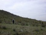 Paul got way ahead, but Kitty took the time to admire the many small plants that had really greened the area after the generous winter rains.
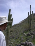 We're now just a bit below (and to the west) of the "CG".
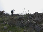 Paul is almost at the crest of the ridge and passed by a lush small ocotillo growing among the many large rocks that make up a large portion of this mountain. Some put out blooms before leafing, and others do not; age and or location of the plant may be factors since many of the ones in the virgin desert areas of our house have blooms.
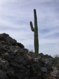 Kitty has always been fascinated by color and texture contrasts, seen here with this saguaro growing among the large sharp dark rock.
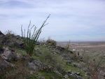 Three ocotillos on the hillside - with the remains of a dead one just to the left of the young one on the right - and Interstate 8 disappearing into the horizon.
This area has numerous Teddy Bear Chollas, which are just as susceptible to "jumping" or being picked up on one's shoes or pants as the Hanging Chollas that are the variety commonly given the "Jumping Cholla" name. The way to walk through such an area as this is slowly, away from the plants themselves and carefully avoiding all detached stems. If such a stem is found to be attached to clothing, do *not* touch with fingers. Use 2 sticks, stones or other hard implements to remove.
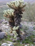 Nestled and protected at the base of this cholla is a group of pincushion cactus. Easy to understand why they are prospering. All the pincushion cactus we saw on this hike appear to be the same variety, the fishhook, in the large genus, Mammillaria.
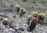 A young ocotillo is prospering in the rocky soil near the base of 2 chollas; 2 fishhook barrel cactus in the foreground.
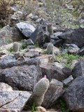 The early blooms on this group of fishook pincushions is most likely a result of them being on a southerly facing slope.
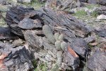 There must be some soil in the crevices of these rocks - sufficient to nourish this group of pincushions. And here's another sharp (pun intended) contrast in textures.
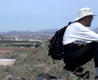 When we hiked far enough to the west, we were right in line with Peart Road. Paul is posing to call attention to the road, just to left of his backpack, seen extending into the distance. If Peart Road were complete and not interrupted by Interstate 10, we would be able to drive directly from our house to this point rather than needing to follow one of several zig-zag routes.
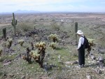 The far end of this ridge is pointed almost directly west; I-8 disappears into the horizon towards Gila Bend, Yuma, the Colorado River and lastly San Diego. Along the way someone can detour south off to TableTop Mountain, seen on the left on the horizon, where we last hiked in March 2009.
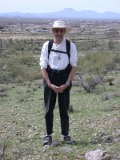 The rock at Paul's feet is one of a relative few in this area that are volcanic. We reason that it may have originated from the same source as all the volcanic matter in the Table Top Preservation in the far distance off to the right of Paul's head.
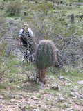 As Paul nears the foot of the ridge and prepares to cross a ravine, Kitty stops to photo a young saguaro that is managing without any flesh at all around the base. It is not uncommon for us to come upon saguaros in this condition, some considerably older and larger. There must be some nutrient system that lies within the skeleton of ribs that continues to nourish the cactus.... we are always amazed when we see this.
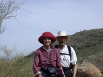 It took almost an hour from the last picture to circle around to the north to reach the ridge with the flagpole. Before we descended Kitty set up the camera for a delayed pic, to show that she was actually on this hike :).
Much of the area that we hiked is a designated park of the city of Casa Grande, but unfortunately has been abused by many users who have littered in some areas, the worst type being the broken glass. No refuse bins are provided and so the 4 bags that we collected (a real "drop in the bucket") were taken away by us and left in a dumpster in town when we did some errands before returning home. A community clean-up along with some bins and "No Litter" reminder signs might help reduce the unsightliness and also potential danger from the broken glass.
MoreLife is Always "Under Construction"
Initially posted 4/1/2010
Page last updated 9/7/2010
Any questions, comments or suggestions regarding the content of this website
should be addressed at MoreLife Yahoo.
For comments on webpage format, contact Kitty
Antonik Wakfer

 Paul patiently waited for Kitty to snap a photo as we started up the first of the rocky areas - away from the heavily off-road vehicle trails. For some unknown reason there is a flagpole on this small rise... apparently errected some long time past. And he waited for her at the saddlepoint before proceeding on.


